
A spectral clustering approach of vegetation components for describing plant topology and geometry from terrestrial waveform LiDAR data
Keywords:
clustering, delineation, elementary plant unit, tLiDAR,
Abstract
xxx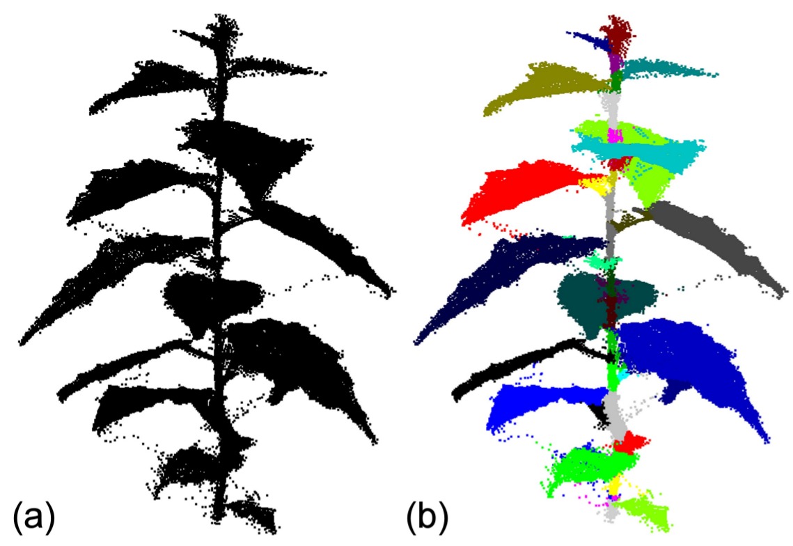
Published
2013-06-03
Issue
Section
1B Reconstructing and observing plant structure
Authors who publish with this proceedings volume agree to the following terms:
- Authors retain copyright and grant the Conference organisers right of first publication with the work simultaneously licensed under a Creative Commons Attribution License that allows others to share the work with an acknowledgement of the work's authorship and initial publication in this proceedings volume.
- Authors are able to enter into separate, additional contractual arrangements for the non-exclusive distribution of the proceeding's published version of the work (e.g., post it to an institutional repository or publish it in a book), with an acknowledgement of its initial publication in this proceedings volume.
